Faculty Development program on Geoinformatics and Related Open Source Technology in SIES, Nerul

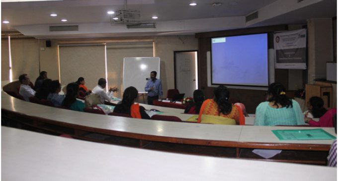
Faculty Development program held in SIES on Geoinformatics and Related Open Source Technology It was first Jointly organised FDP on “Geoinformatics and Related Open Source Technology” by SIES Graduate School of Technology, Nerul Navi Mumbai and Graduate School of Engineering, Osaka City University,Japan.
It was Attended by 20 Faculties from different Institutes.
On first day of FDP, Dr. V. B. Nikam explained importance of geographic information system (GIS) in India’s Development Geoinformatics is the integration of different disciplines dealing with spatial information. The advent of Satellite Remote Sensing and subsequent development of Global Positioning System (GPS) and Geographical Information System (GIS) have made significant changes in surveying and map making. In light of this, both in the academia and the industry, these topics have been brought together under one umbrella term – Geoinformatics.
On Second Day of FDP, Dr.Venkatesh Raghavan and Mr.NatrajVaddadi elaborated Open Data Kit along with the Hands on session. Open Data Kit (ODK) is a free and open-source set of tools to promote mobile data collection solutions.
ODK provides an out-of-the-box solution for users to:
Build a data collection form or survey
Collect the data on a mobile device and populate a server
Aggregate data on a server and extract it in useful formats
On Third Day of the Event, Mr.NatrajVaddadi and Er. H. K. Solanki elaborated QGIS (previously known as Quantum GIS) is a free and open Source cross plat-form desktop geographic information system (GIS) application that supports viewing, editing, and analysis of geospatial data.
QGIS supports both raster and vector layers; vector data is stored as either point, line, or polygon features. Multiple formats of raster images are supported, and the software can geo-reference images.
[SLGF id=2564]


There are no comments at the moment, do you want to add one?
Write a comment